

Nigel Bruce

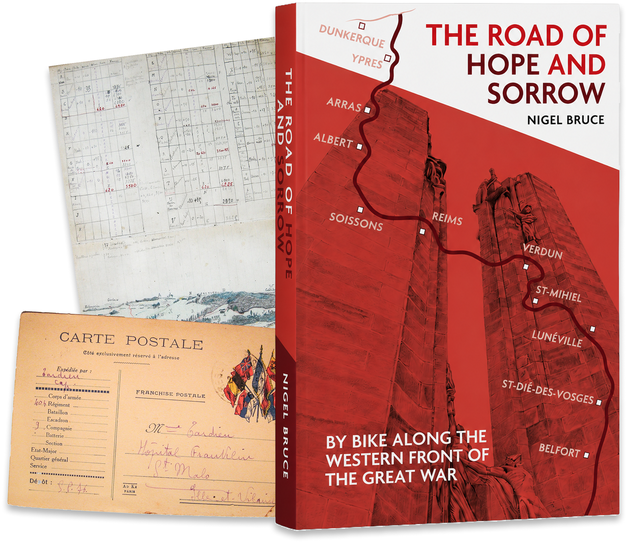
The Road of Hope and Sorrow

By bike along the Western Front of the Great War

Nigel Bruce

A journey through history, memory and landscape

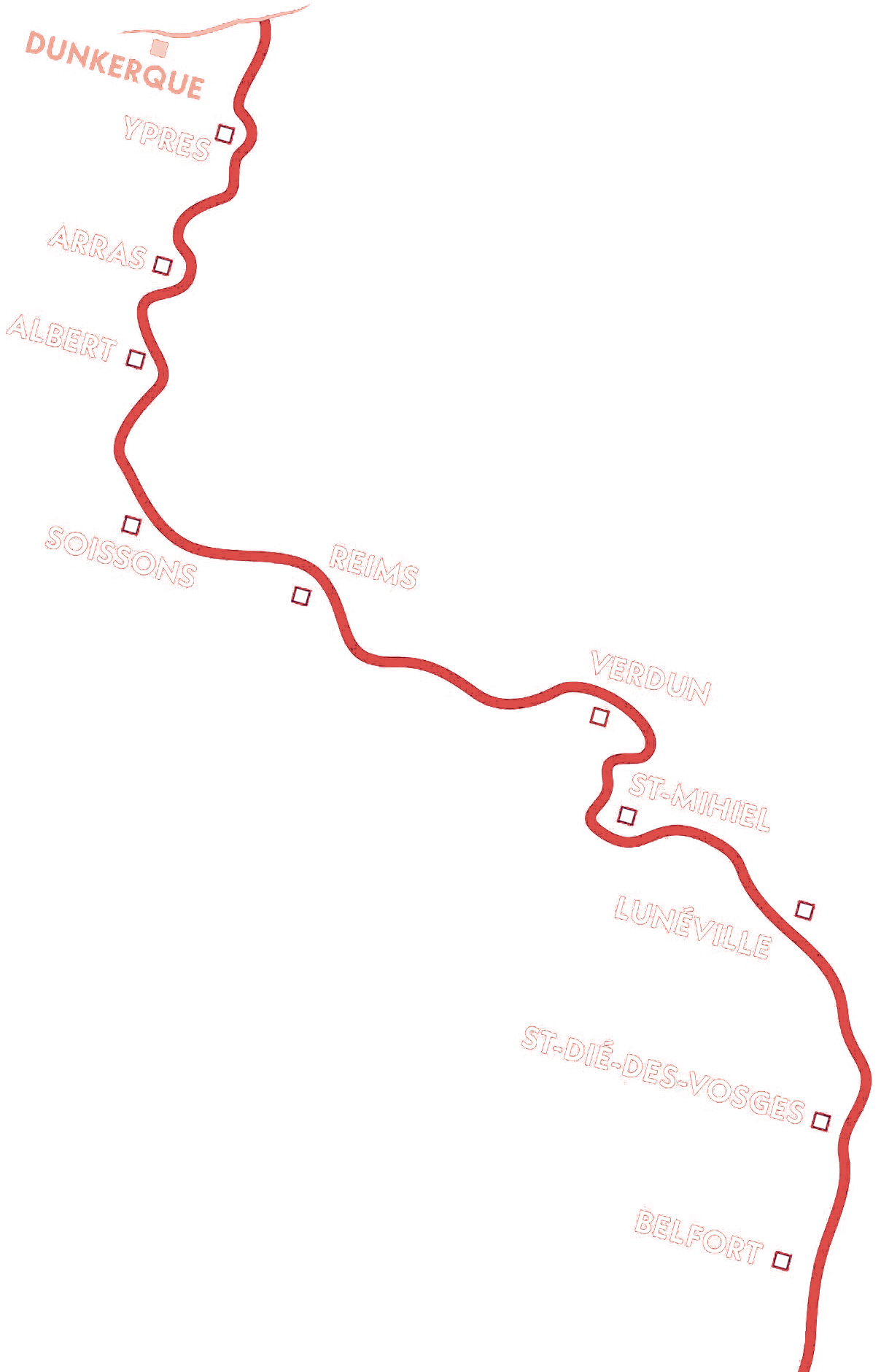
In 2016, Nigel Bruce cycled more than 1,000 kilometres along the Western Front, following the line of the many battles that took place along the Front from 1914 to 1918 between the Belgian coast and the Swiss border beyond The Vosges Mountains.

This deeply personal account weaves history, travel writing, poignant memoir and rich photography to bring to life the towns, villages, memorials and landscapes forever shaped by the Great War.

A comprehensive guidebook, beautifully illustrated, and a tender tribute to the fallen of every nation.

Tom Heap
Tom Heap

Broadcaster and co-founder of ‘The Western Front Way’

About the Author

Cyclist. Historian. Storyteller.

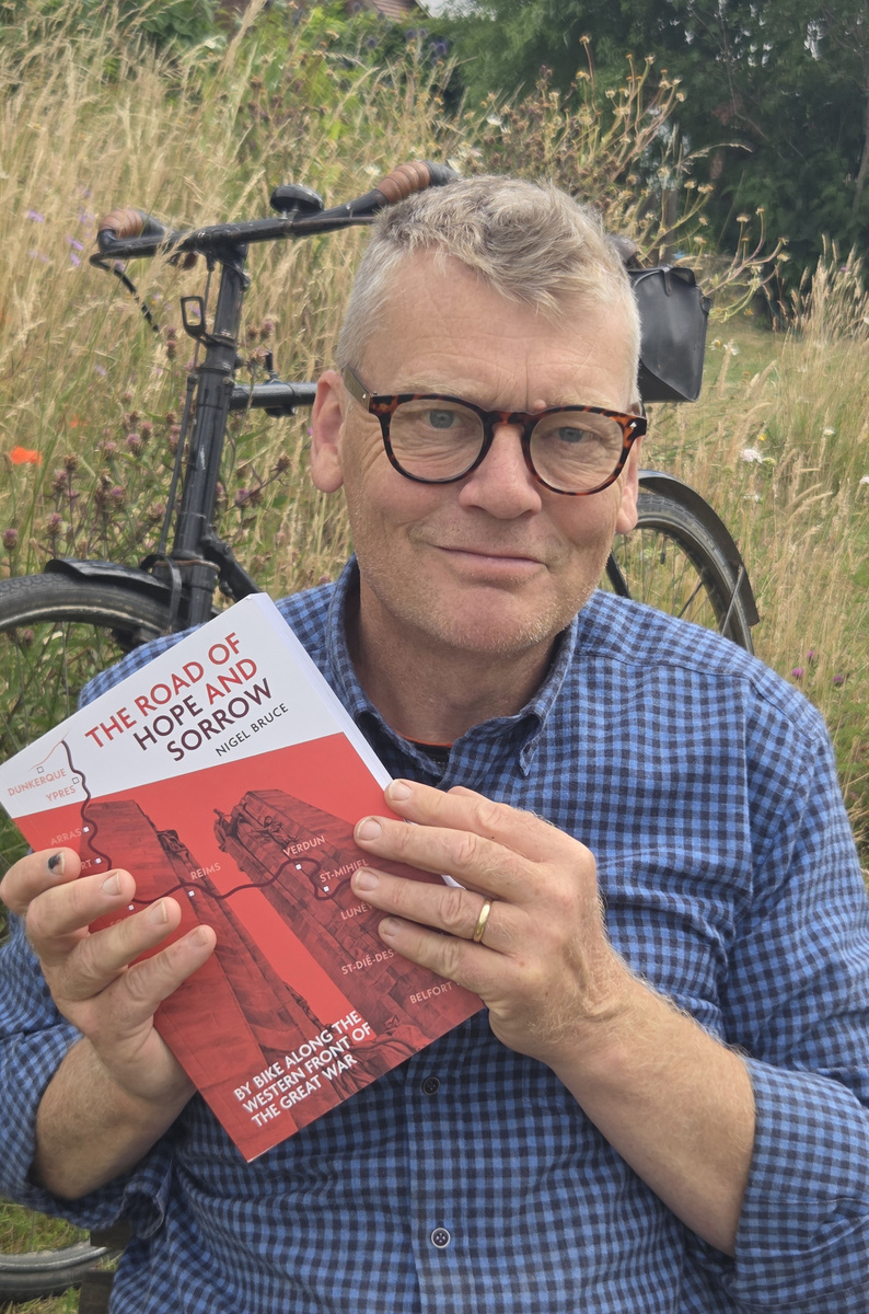
Nigel Bruce is a passionate cycle tourist and enthusiastic student of history. A former public-health professional, he has long been drawn to journeys that combine physical challenge with intellectual curiosity and human connection.

Through writing, photography and research, he seeks to honour the experiences of those who lived and fought along the Western Front—and to keep their stories relevant today.

To ride is to listen. To remember is to give their stories the journey that continues.

Nigel Bruce

The Road of Hope and Sorrow

Latest from the blog

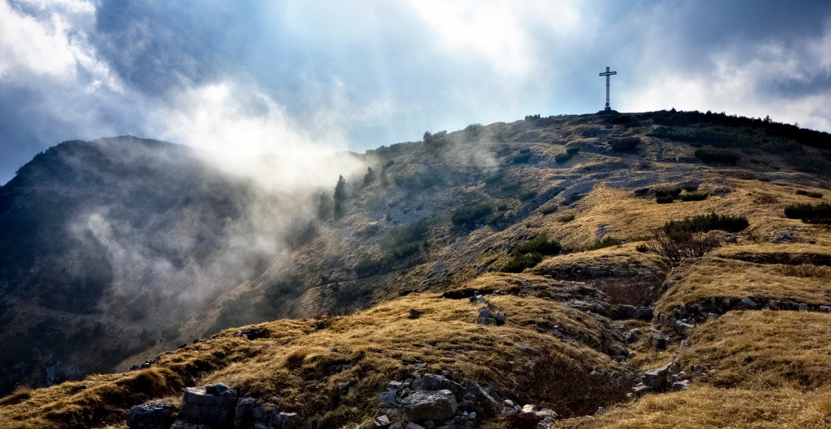
The cross on the top of Mount Maggio and the trenches of the Great War (Trentino, Italy).
Reflections & Reviews

Perspectives from a fellow cycle tourist and Great War history enthusiast

Having really enjoyed Tom Isitt’s Riding the Zone Rouge: The Tour of the Battlefields 1919 – Cycling’s Toughest-Ever Stage Race, a fascinating book telling the story of the 1919 cycle race held through the devastated battlefields of the Western Front and Tom’s own ride along the route, I was excited to see and start reading his latest book, Thunder in the Mountains: The First World War on the Italian Front.

I wanted to find out what Tom might make of my adventures along the Western Front and how I had written these up in The Road of Hope and Sorrow. I felt it would be worthwhile sharing what another author with an enduring interest in the Great War, and who is clearly also committed to the concept of exploring history by bike, might have to say.

Here are Tom’s comments:

I’ve read a dozen or so books about travelling the Western Front of the Great War, from an immediate post-war pilgrimage by Henry Williamson to more recent walks by notables such as Sir Anthony Seldon. I even wrote my own book about cycling the Western Front in the wheeltracks of the 1919 Circuit des Champs de Batailles bike race. I’ve visited the Western Front more than 20 times, and feel I know it quite well.

Many of these books follow an established pattern, interspersing a bit of Great War history with a lot of the author’s more or less interesting observations and anecdotes. So, when I received a review copy of The Road of Hope and Sorrow, I was interested, but not hopeful that it would add much to the genre. I was very wrong.

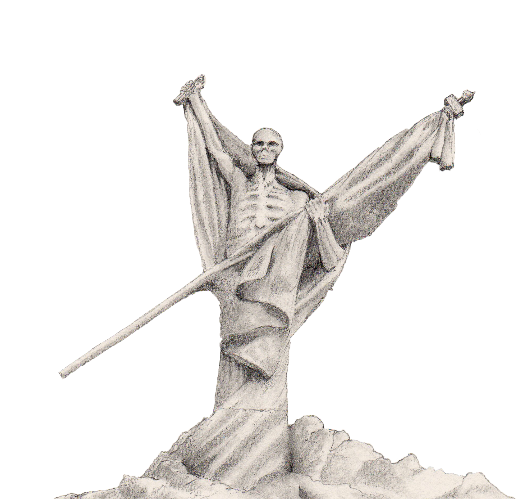
The first surprise was the size of the book, a large-format paperback with 536 pages, weighing 1.27kg. It definitely passes the “drop test” — it makes a hefty thud if you drop it on a coffee table. The next surprise was the sheer quantity and quality of photos, maps, and illustrations: more than two hundred contemporary photos and almost sixty archive images, thirty maps, nine war art reproductions by the likes of Anna Airy, Olive Mudie-Cooke, Paul Nash, Richard Jack and Otto Dix, and ten wonderful line-drawings by the author.

Nigel Bruce is clearly a very accomplished photographer, cartographer, and artist, and the design and layout of the book makes it feel more like a magazine than a book. It’s visually very appealing, and the text is broken up with First World War art, poetry, and tables laying out the progress of various battles in a very clear way.

With regards to the text, I’m not a Western Front expert so am in no position to critique the historical stuff, but I didn’t find any obvious howlers and Bruce’s words are authoritative, but not too dry. The same applies to his cycling narrative, which doesn’t get bogged down with the minutiae of the ride, but gives enough of a flavour to make me want to get back on my bike and head for France and Belgium. But in some ways the cycling is almost incidental, it doesn’t overwhelm the rest of the book, and this book would work equally well as a driving companion.

Another thing I really liked about The Road of Hope and Sorrow is each chapter begins with a sort of list of what’s in the chapter. This was very common in books published at the beginning of the 20th century, and is a nod in the direction of old-style publishing in a very modern-looking book.

It’s been quite a while since I read something that really wowed me, but The Road of Hope and Sorrow did just that. Some of his observations about the benefits of cycling the battlefields, and making maps of those battlefields, really struck a chord with me, and as I read it I felt that we are very like-minded battlefield tourists. The multi-talented Bruce has produced something very engaging, visually appealing, and readable.

Tom Isitt
Historian, explorer, photographer, and author of two recent books themed on exploring the Great War by bike:

  1. Riding the Zone Rouge: Cycling’s Toughest-Ever Stage Race (Weidenfeld and Nicolson, 2019)
  2. Thunder in the Mountains: The First World War on the Italian Front (Helion Books, 2026)

Once I have completed reading Thunder in the Mountains, I’ll add some of my thoughts here on this fascinating book. Perhaps the first thing to say is that Tom Isitt’s book is very welcome, indeed long overdue, as despite the political importance of the Italian Front and the vast human cost of the fighting in some of the most appalling conditions, in comparison with what is available for the Western Front, there is very little out there to inform and guide travellers wishing to explore the mountain battlefields and Great War history of the conflict between Italy and the Austro-Hungarian Empire.
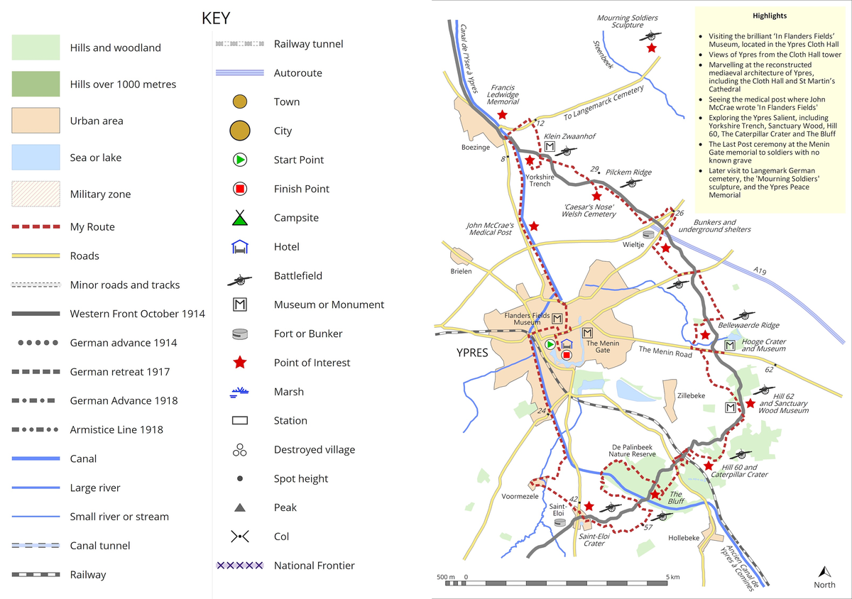
This map shows the route of my exploration of the Ypres salient, starting and finishing in the city of Ypres.
The Road of Hope and Sorrow

About the maps in The Road of Hope and Sorrow

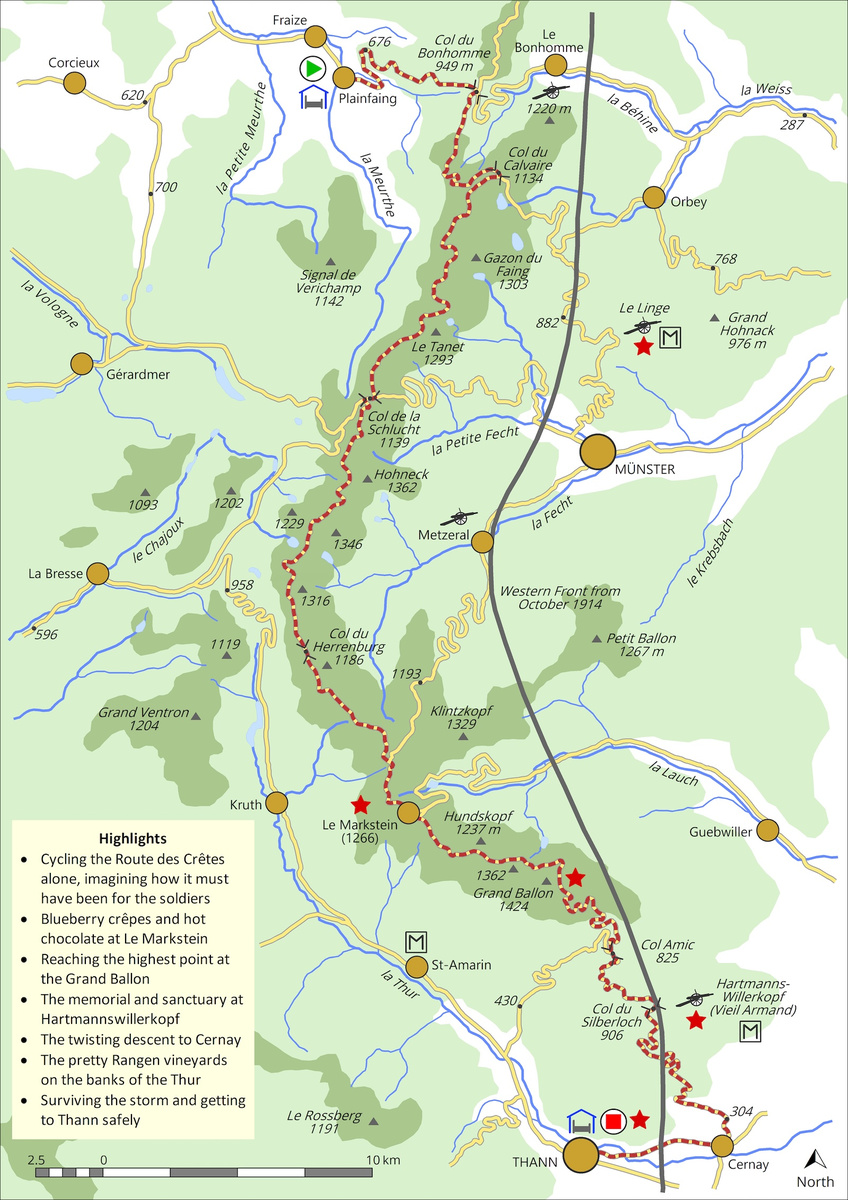
With this Western Front project, maps were, for me, another very important part of telling the story, and one that I hope will help others planning trips to all or part of the Western Front. Creating these maps (for which I used MapMaker Pro Version 4), brought me much closer to the landscapes I had cycled through. Many hours spent tracing the course of rivers, identifying towns and villages – some of which vanished in the maelstroms of shellfire and exist now only as villages détruits (destroyed villages) – historic features, hills and woodlands, helped me understand the physical and human features of the terrain, and complemented accounts of the battles that were fought across these lands. I have included two of the day-ride maps from my book here by way of example, together with the key that explains the symbols used and information I have sought to provide the reader.

This map shows the route of my exploration of the Ypres salient, starting and finishing in the city of Ypres.
Now, almost at the south-eastern end of the Western Front, this second map shows my ride along the former Great War French military road, known as the Route des Crêtes, which passes the mountain battlefields of Le Linge and Hartmannswillerkopf on the high ridge of the Vosges Mountains in Alsace. The majority of this road lies at an altitude of more than 1100 metres, and it crosses close to the summit of the Vosges’ highest peak, Le Grand Ballon (1424 metres).
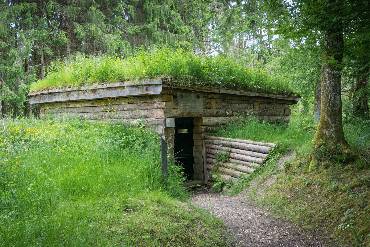
The recently restored bunker close to the site of Kilometre Zero on the Swiss border
The Road of Hope and Sorrow

A surreal setting for the southeastern end of the Western Front on the Swiss frontier

An excerpt from Chapter 24: The Forest of War and Peace

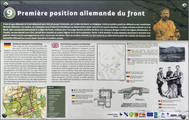
Less than 100 metres from the Swiss border stood a gun emplacement which marked the first German fortification of the Western Front. Or the last, depending on which way you are facing. This featured a revolving cannon, an illustration of which is provided on the information panel nearby (see photo).

I was now past the muddy section and able to ride my bike again. Many years ago, before the outbreak of the Great War, a farm and grocery known as the Petit Largin stood near here on the Swiss side of the border. Around 1890, the owner built an inn opposite his property, but this was just inside Alsace, which at the time was part of the German Empire. The authorities placed a frontier marker stone, one of several along this section of the path, to show that different customs and excise rules applied to the Swiss grocery and the German inn.

Although the farm disappeared around 1900 and the inn was destroyed by German shellfire in 1914, this border crossing was to play an important role in the Second World War. When Gauleiter Robert Wagner announced in 1942 that Alsatian men would have to enlist in the German army, many sought to escape. The salient of Swiss territory provided a well-used route, and on just one day in February 1943, a total of 183 men made it out of Alsace and into neutral Switzerland.

The first (or last for me) German position of the Western Front.

The first (or last for me) German position of the Western Front.

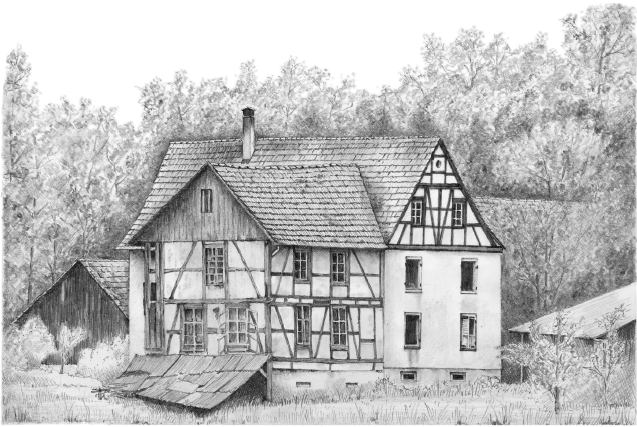
On the far side of the river, in the corner of a field, stands the Largin Farm. It looks somewhat dilapidated now, but peering at it through the trees I could imagine those Alsatian men, desperate to avoid conscription, scrambling across the stream in the depths of a freezing winter night, racing across the field to the sanctuary of the farm, and on to freedom.

It is said that, as they made their escape, they sang ‘Vous n’aurez pas l’Alsace et la Lorraine’ (You will not have Alsace and Lorraine).

The Largin Farm just inside the Swiss border by Nigel Bruce

The Largin Farm just inside the Swiss border

by Nigel Bruce

A timber footbridge constructed by Swiss army engineers in 2012 took me over the Largue river and into Switzerland where I found Marker Stone 111.

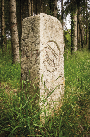
Placed in 1743, it carries the marks of episodes in the turbulent history of Alsace. Carved on the southern facet is the bear of Berne, signifying the moment in 1815 when the Episcopality of Basel (which includes the nearby community of Bonfol) was incorporated into the Canton of Berne. On the reverse side, the date 1793 recalls the year when the short-lived Rauracian Republic, created in 1792 from part of the Holy Roman Empire located in what is now the Swiss Jura, was annexed by France. The date 1817 on the western side of the marker was added when officials confirmed the border in that year, while other markings on the French side attest to changes of sovereignty.

Marker stone 111, placed on the Franco-Swiss border in 1743, its carved sides a witness to the turbulent history of this region and the location of Kilometre Zero

Marker stone 111, placed on the Franco-Swiss border in 1743, its carved sides a witness to the turbulent history of this region and the location of Kilometre Zero

This modest stone held a very special significance for my journey along the Western Front. Planted on the Swiss border between the French and German lines, and watched over by the neutral Swiss, it marks the strange but very real point known as Kilometre Zero.

Beside this stone, I was standing in the midst of a forest of war and peace. Across just a few metres of woodland, political circumstances determined that while French and German citizens would be ordered to kill each other, both could meet, talk and laugh with their Swiss counterparts – as illustrated so poignantly in the information panel at the site. All of the blood, shells, bullets, gas, pain and death just stopped here, on an ill-defined line beside a small stream in the woods of Southern Alsace. Try explaining that to a child.

And to emphasise this extraordinary reality, just across from Marker 111 is Swiss Observation Bunker No. 2. There is nothing left of the original, as it was built from timber and earth since the Swiss needed protection only from stray bullets and the occasional deliberate shot, presumably from a frustrated German or French soldier.

Nigel Bruce’s richly illustrated, informative and thoughtful book brings the war uniquely to life.

Sir Anthony Seldon

Historian, educator and author of The Path of Peace; Walking the Western Front Way

Get in Touch

Whether you have a question about The Road of Hope and Sorrow, would like to discuss Nigel Bruce’s journey along the Western Front, or are interested in inviting him to speak at an event, please use the form below to get in touch.